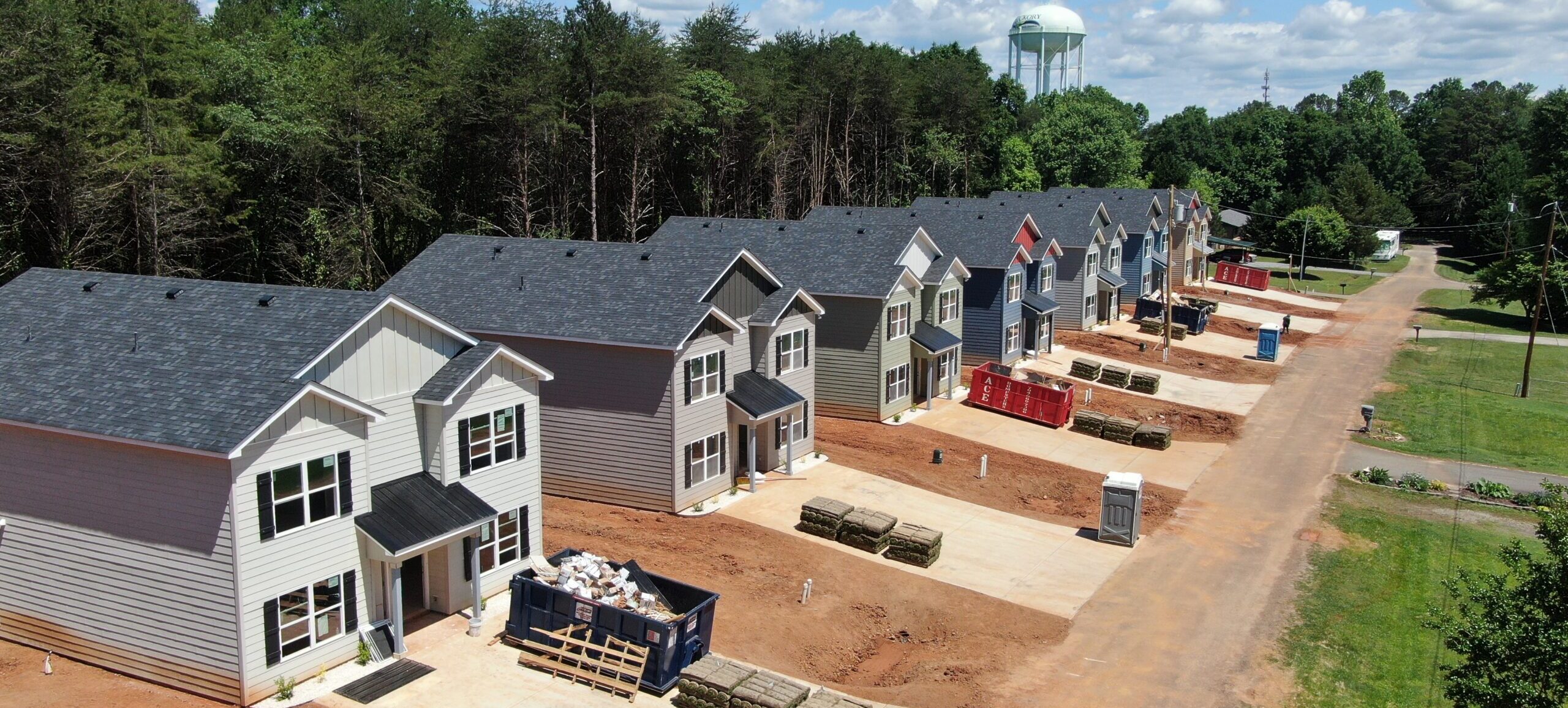
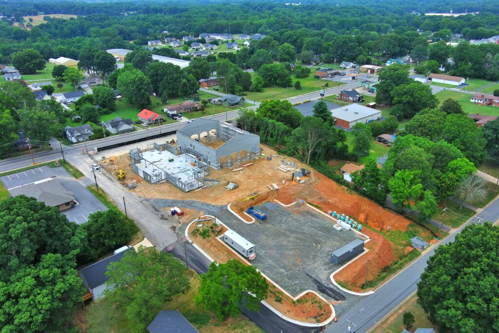
Can’t make it to your job construction site? No worries, you don’t have to be on the site to know what’s happening with your construction build. With drone data collection tools you can keep up to date with your job site through still imagery, video, and 2 dimensional modeling.
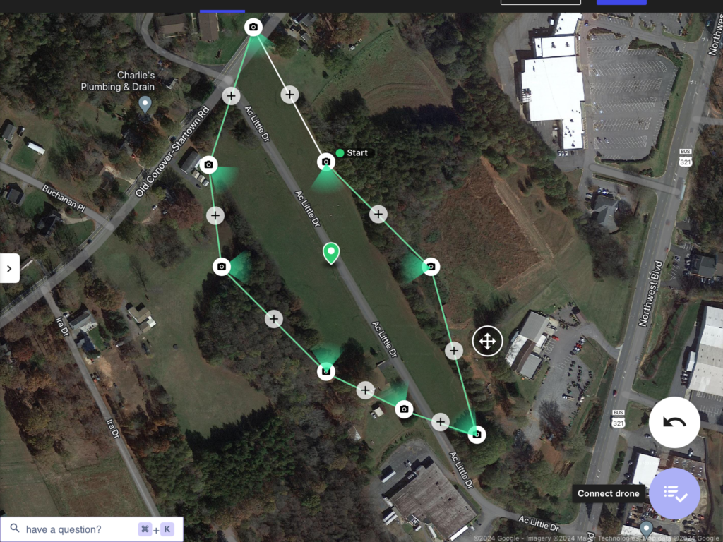
With drone technology unique flight paths for still images, video, and image models can be saved after the first drone flight of your build. Those flight paths are re-used each to show week to week, or month to month progressions. The saved flight plans can be used to follow the same video path, take photos from the same locations, and generate site models.
This means you’ll be able to see the progress of your build on your own private custom pages here at See Your Build by DronesAbove.
With drone autonomous flights, your build site flight plan can be documented and saved for multiple site visits easily.
Still Imaging
With these saved flight paths, our drones can visit select locations on your site to show the overall changes. You’ll be able to compare the progress on your site with a quick glance.
Video Timelapse
Similar to the still imaging, re-usable flight paths can be flown repeatedly to show overall job site progress.
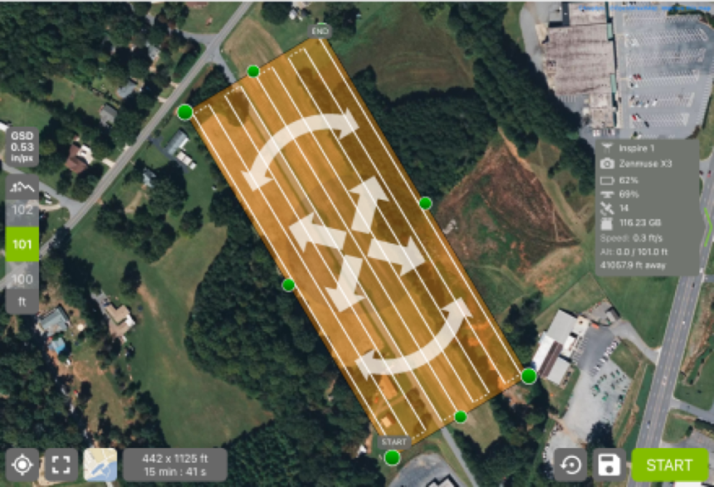
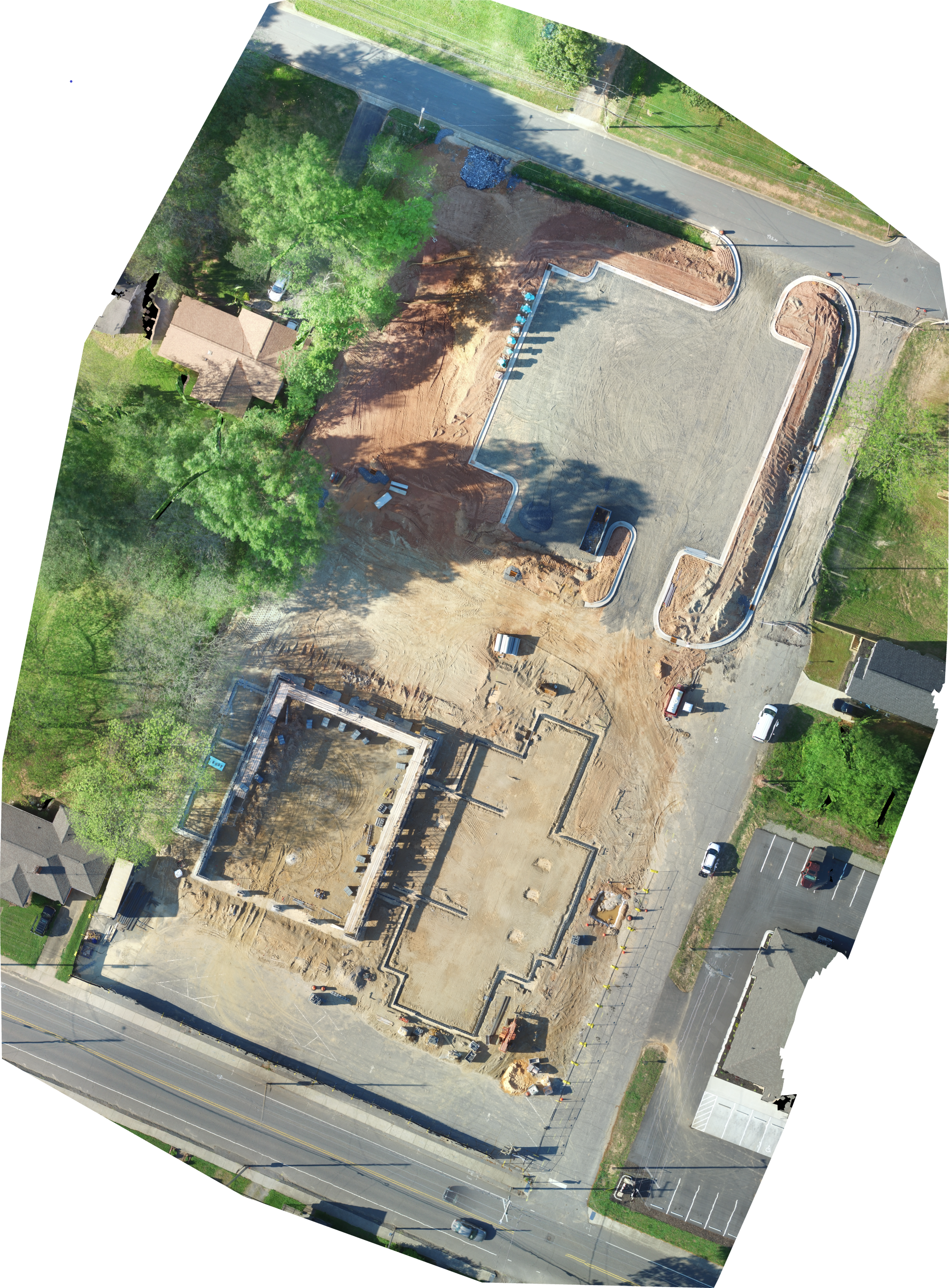
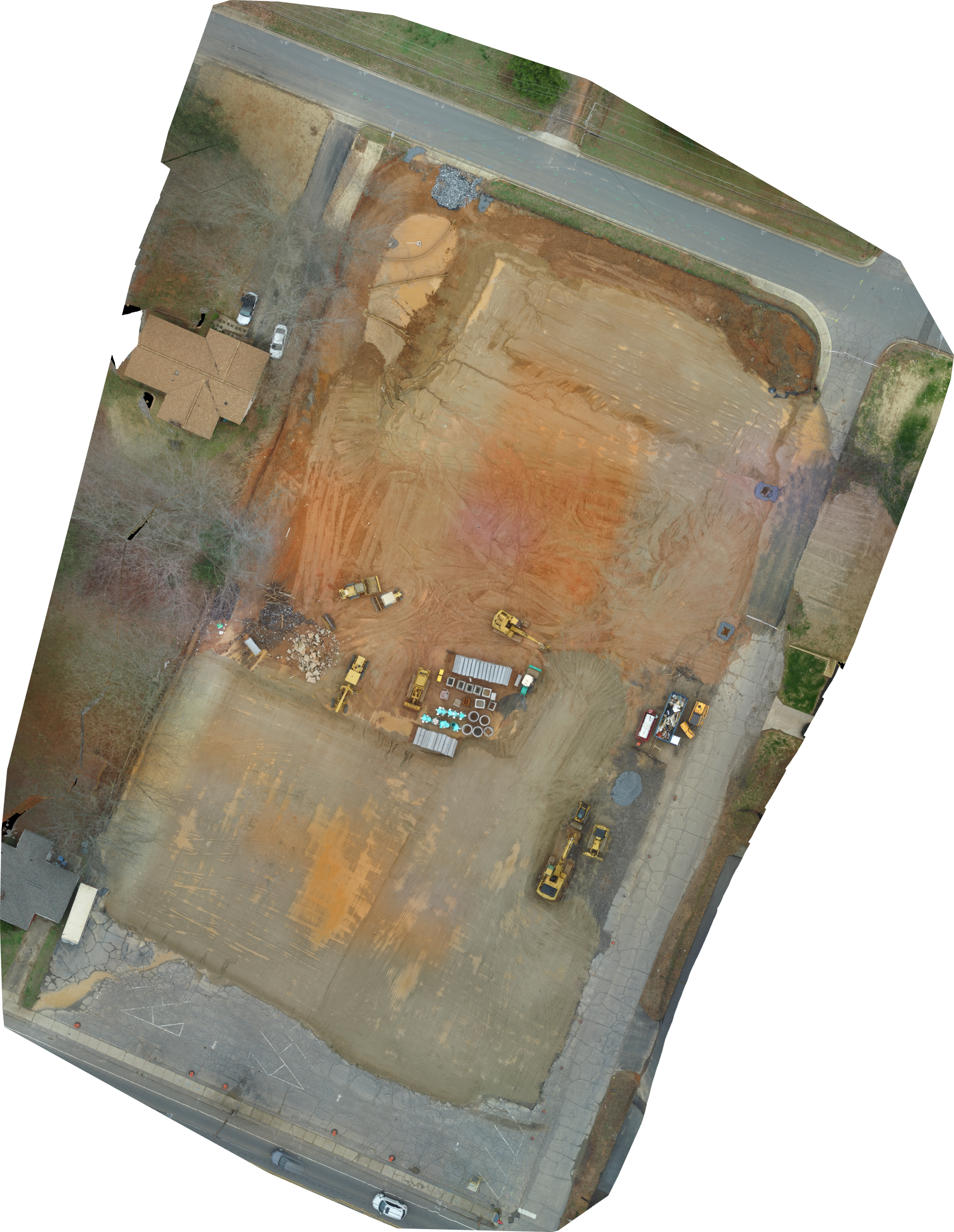
2D & 3D Maps
With drone maps your overall job site can be viewed easily. You can see changes in material piles, fill piles, and more. 2D Orthomosaic models can offer a lot of information.